
CSMP IAS : India's Premier Coaching Institute for IAS / PCS
Glacier Disaster Risk and Flash Flood Threat in Himalayas
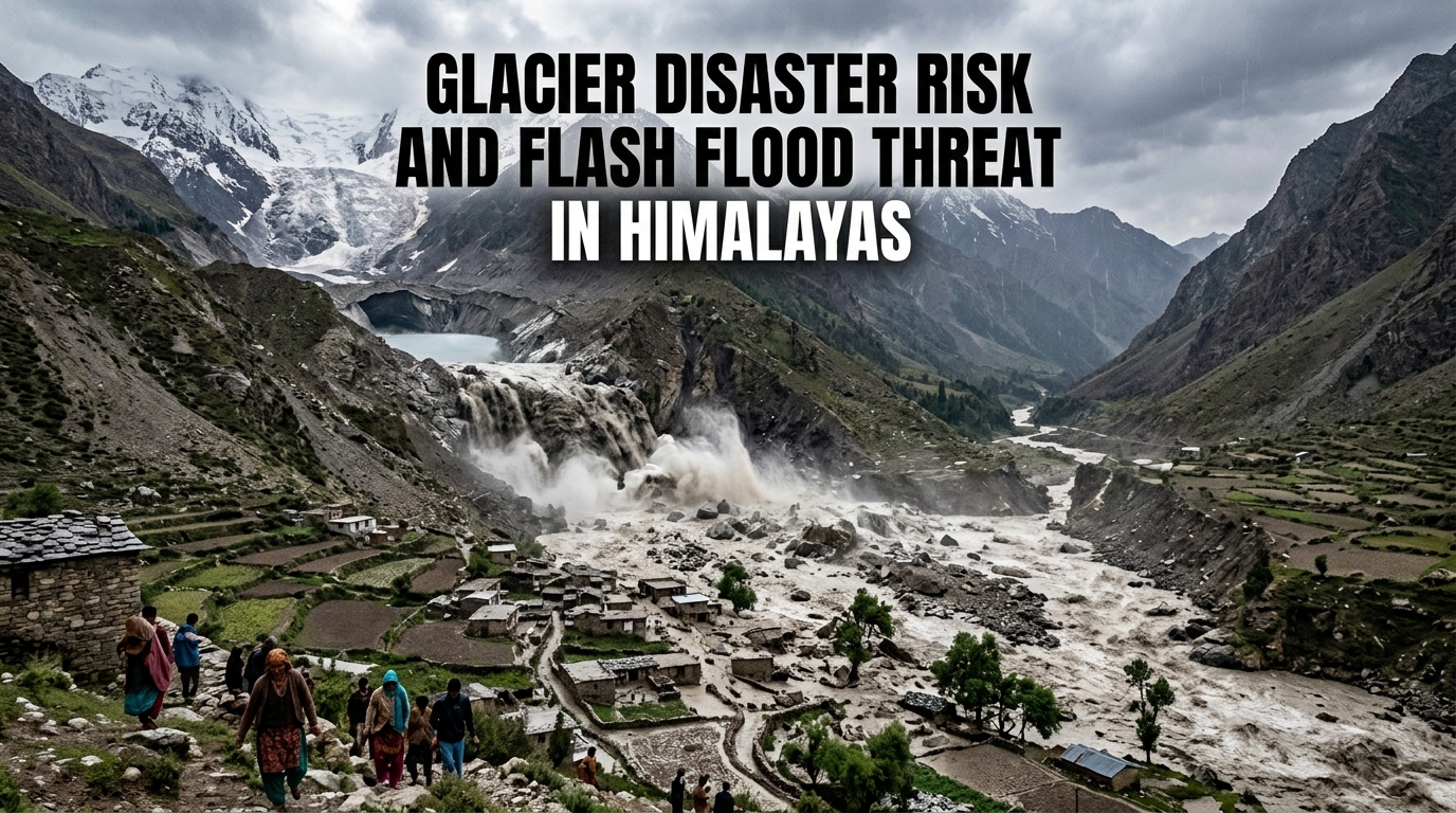
Glacier disaster risk is increasing in the Himalayas as seen in the Dharali flash flood caused by glacier instability. Understanding glacier disaster risk is essential to improve early warning systems, disaster preparedness, and climate adaptation.
Why in the News?
- A scientific study by the Indian Space Research Organisation analysed the flash flood that occurred in Dharali village in Uttarakhand on August 5, 2025.
- The study was published in the journal NPJ Natural Hazards, which focuses on disaster research.
- The flash flood destroyed Dharali village and caused loss of lives and property.
- This event raised serious concerns about increasing glacier-related disasters in the Himalayas.
- The study identified the main cause as the collapse of an exposed ice patch on the Srikanta Glacier.
- It emphasized the importance of using satellite monitoring to detect early signs of such disasters.
What are the Key Highlights of Glacier Disaster?
Cause of the Flash Flood
- The flash flood was caused by the sudden collapse of an ice patch in the glacier’s upper region.
- An ice patch is a part of a glacier where ice is exposed due to melting of snow layers.
- This collapse occurred in a nivation area.
- Nivation is a process where repeated freezing and melting weakens the ground and ice.
- The collapse released a mixture of water, ice, and debris.
- This mixture flowed rapidly downstream and caused sudden flooding.
- This type of flood is called a flash flood because it happens quickly without much warning.
Geography of the Study Area
- Dharali village is located in the Uttarkashi district of Uttarakhand.
- It is situated at a high altitude of around 2,650 to 2,700 meters.
- The village lies along the Khir Gad stream.
- This stream originates from the Srikanta Glacier and joins the Bhagirathi River.
- The stream divides the village into two parts.
- This increases vulnerability because water can affect both sides easily.
- The region is already prone to disasters.
- It experienced the 2013 Uttarakhand floods, which caused widespread damage.
Exposed Ice Patches and Deglaciation
- Exposed ice patches are areas where protective snow cover has melted away.
- Firn is partially compacted snow that normally protects glacier ice.
- Deglaciation means the gradual loss of glaciers due to warming temperatures.
- Rising temperatures melt snow and ice faster than they are formed.
- Exposed ice patches are unstable.
- They can collapse suddenly due to heat, rainfall, or structural weakness.
- The presence of such patches before the flood showed that the glacier was already weakening.
Role of Satellite Observations
- Satellite images were used to detect changes in the glacier.
- These images showed exposed ice during the ablation period.
- Ablation period means the time when glaciers lose more ice than they gain.
- This usually happens during summer months.
- Satellite monitoring helps in identifying risk areas.
- It is especially useful in remote Himalayan regions where physical access is difficult.
- Similar glacier hazards have been observed in polar regions.
- For example, Greenland and the Canadian Arctic also face ice collapse risks.
Nivation Hollows and Cryospheric Hazards
- Nivation hollows are small depressions formed by snow accumulation and melting.
- These areas are weak and sensitive to temperature changes.
- Cryosphere refers to all frozen parts of Earth, such as glaciers, ice caps, and snow.
- Cryospheric hazards are dangers related to melting or instability of ice.
- Sudden collapse in nivation hollows can release large amounts of water and debris.
- The Dharali event shows that even small glacier features can cause large disasters.
What are the Significance?
Early Warning Systems
- Monitoring glaciers can help predict disasters before they happen.
- Satellite data can identify unstable ice patches early.
- Early warning systems can alert communities in advance.
- This can save lives and reduce damage.
Disaster Preparedness
- Understanding glacier hazards helps in better planning.
- Authorities can identify high-risk areas and take preventive steps.
- Infrastructure can be designed to withstand floods.
- For example, stronger bridges and drainage systems can reduce damage.
Climate Risk Awareness
- The study shows a clear link between climate change and glacier instability.
- Rising temperatures are increasing melting of glaciers.
- Exposed ice patches are a new type of risk.
- Earlier, focus was mainly on glacial lake outburst floods.
Scientific Insights
- The study adds new knowledge about glacier-related disasters.
- It shows that not only lakes but also ice patches can cause floods.
- It highlights the importance of studying small glacier features.
- This improves overall understanding of mountain hazards.
Challenges
Rapid Glacier Changes
- Glaciers in the Himalayas are melting quickly due to climate change.
- This increases the formation of unstable ice patches.
- Sudden changes make prediction difficult.
- Disasters can occur without clear warning signs.
Limited Ground Monitoring
- High-altitude areas are difficult to access.
- Physical monitoring of glaciers is expensive and risky.
- Lack of real-time data reduces preparedness.
- Authorities depend mainly on satellite data.
Lack of Early Warning Systems
- Many villages do not have proper alert systems.
- People receive little or no warning before floods.
- Disaster management plans are not fully developed for such events.
Low Awareness of Cryospheric Hazards
- Many people are unaware of risks from glacier instability.
- Focus is mostly on large events like glacial lake floods.
- Small changes in glaciers are often ignored.
- This increases vulnerability of local communities.
Way Forward
Satellite-Based Monitoring
- Regular satellite observation should be used to track glaciers.
- Changes in snow cover and ice thickness should be monitored.
- Early signs of instability should be identified.
- This can help issue timely warnings.
Risk Mapping
- High-risk areas should be identified and mapped.
- Nivation hollows and steep slopes should be marked as danger zones.
- These maps should be used in planning and development.
- This will reduce construction in risky areas.
Community Preparedness
- Local communities should be educated about glacier hazards.
- Awareness programs can teach people how to respond during floods.
- Evacuation plans should be prepared.
- Regular drills can improve readiness.
Climate Adaptation Measures
- Policies should include glacier monitoring and protection.
- Climate adaptation means adjusting systems to reduce damage.
- Infrastructure should be strengthened.
- Buildings and roads should be designed to handle sudden floods.
Research and Collaboration
- More research should be done on glacier hazards.
- Scientists should study similar events in other regions.
- Collaboration between different fields is important.
- Glaciology, hydrology, and disaster management should work together.
Conclusion
Mountain regions are becoming more sensitive due to changing climate conditions, which makes even small environmental changes highly dangerous. A scientific and community-based approach that combines technology, awareness, and planning can help reduce risks and protect vulnerable populations in these fragile ecosystems.
Relevant Articles:
Pulses Policy Reform for Stronger Farmer Income
Water-Centered Climate Adaptation: A Strong Step from COP 30
Global Oil Crisis and Energy Security Challenges for India
Read Also:
SC Status and Religion Debate in India: Supreme Court Clarifies Reservation Rules
India Heart Attack Care Crisis: Delays in Treatment Increasing Preventable Deaths
Magnetic Field Discovery: New Study Reveals Longer Earth Reversal Duration
disaster response in glof events
