
Continental Drift Theory: A Complete Guide for UPSC Aspirants
Introduction
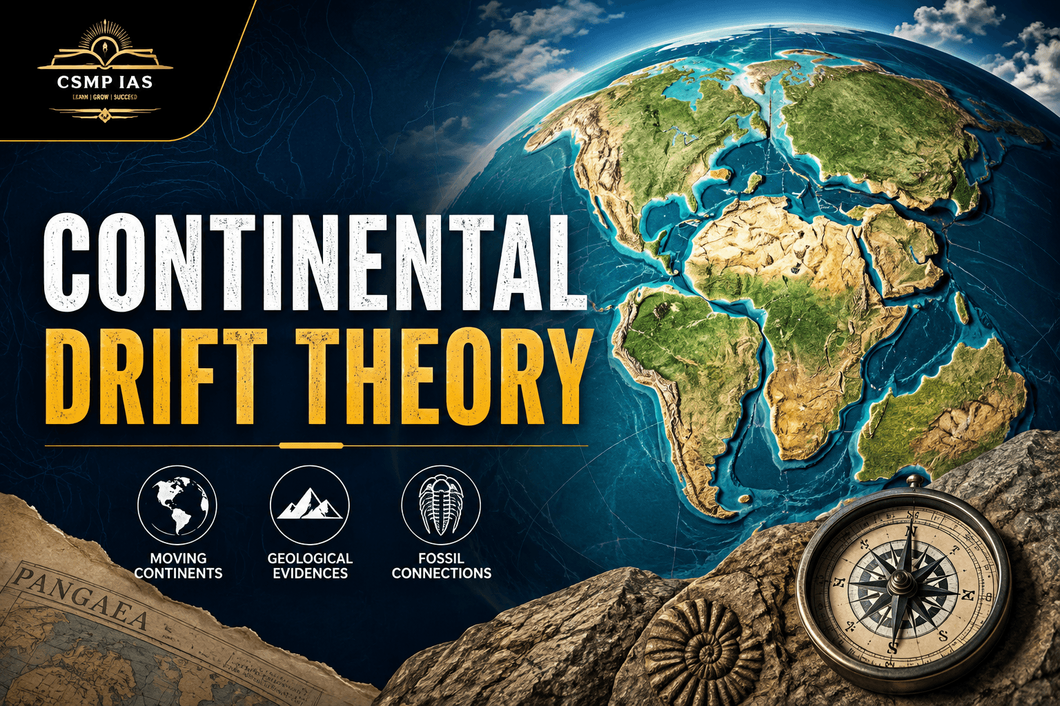
Few ideas in the history of science have travelled as dramatic a path as the Continental Drift Theory. Proposed in 1912 by the German meteorologist and geophysicist Alfred Wegener, the theory was initially ridiculed by the scientific establishment, only to be vindicated decades later as the conceptual seed from which modern Plate Tectonic Theory grew. For UPSC aspirants, Continental Drift Theory is not merely a historical curiosity — it is a foundational topic in Physical Geography that recurs in the Prelims (as factual, map-based, and concept-based questions) and forms the analytical backbone of Mains answers on the origin of continents, distribution of landforms, seismic and volcanic belts, and the broader theme of endogenic processes shaping the Earth's crust. This article builds the concept from the ground up, covers the evidence for and against the theory, situates it within the evolution of geological thought leading to Plate Tectonics, and closes with UPSC-specific preparation strategies, including how to structure Mains answers and handle Prelims-style questions on the topic.
1. Setting the Stage: Why Did Scientists Look for a Theory Like This?
Before Wegener, the dominant explanation for similarities between landforms on different continents was the "Land Bridge Theory." Geologists observed that fossils of the same plant and animal species were found on continents now separated by vast oceans — for instance, identical fossil ferns (Glossopteris) in South America, Africa, India, Australia, and Antarctica. Since the idea of continents physically moving seemed absurd at the time, scientists proposed that narrow strips of land, or "land bridges," once connected these continents and later sank beneath the ocean, explaining the fossil similarities without requiring continents to move.
This explanation, however, was increasingly unsatisfying. It required an enormous number of ad hoc land bridges, all of which had conveniently disappeared without a trace. It was against this backdrop that Wegener proposed a radically different idea: what if the continents themselves had once been joined together and had since drifted apart?
2. Alfred Wegener and the Birth of Continental Drift Theory
Alfred Lothar Wegener first presented his ideas in a 1912 lecture and later elaborated them in his 1915 book, The Origin of Continents and Oceans (Die Entstehung der Kontinente und Ozeane). Wegener's starting observation was deceptively simple: the coastlines of South America and Africa appeared to fit together like pieces of a jigsaw puzzle, particularly the bulge of Brazil fitting into the Gulf of Guinea.
From this observation, Wegener developed a comprehensive hypothesis:
All the continents were once joined together in a single supercontinent, which he named Pangaea (meaning "all earth" in Greek), surrounded by a single vast ocean called Panthalassa.
Around 200 million years ago, in the late Triassic period, Pangaea began to break apart.
The fragments — the continents we know today — drifted slowly across the Earth's surface over millions of years to reach their present positions.
This drifting process, according to Wegener, continues even today, though at an imperceptibly slow rate.
Wegener proposed that Pangaea first split into two large landmasses:
Laurasia in the north, comprising present-day North America, Europe, and most of Asia.
Gondwanaland (or Gondwana) in the south, comprising South America, Africa, India, Australia, and Antarctica.
These two landmasses subsequently fragmented further into the continents we recognise today.
3. Evidence Presented by Wegener
Wegener assembled evidence from multiple disciplines — geology, palaeontology, climatology, and biology — to support his theory. This multidisciplinary approach is itself an important point for UPSC aspirants to note, as questions often test knowledge of the specific category of evidence.
3.1 Geometrical (Jigsaw-Fit) Evidence
The most visually striking evidence was the remarkable fit between the coastlines of continents separated by the Atlantic Ocean, especially the eastern coast of South America and the western coast of Africa. When plotted not at the coastline but at the edge of the continental shelf (a more geologically accurate boundary), the fit becomes even more precise.
3.2 Geological Evidence
Wegener pointed to matching rock formations and mountain belts on continents now separated by oceans:
The Appalachian Mountains of North America align geologically with the Caledonian Mountains of Scotland and Scandinavia.
Rock strata in Brazil correspond closely with rock strata in West Africa.
Ancient mountain ranges in South Africa (the Cape Ranges) show structural continuity with the Sierra de la Ventana ranges in Argentina.
If these landmasses had always been separated by wide oceans, such continuity of geological structures across thousands of kilometres of ocean would be an extraordinary coincidence.
3.3 Palaeontological (Fossil) Evidence
This is among the most frequently tested points in UPSC Prelims. Identical fossils of both flora and fauna were found on widely separated continents:
Glossopteris, a fern-like plant, found in India, South Africa, South America, Australia, and Antarctica.
Mesosaurus, a small freshwater reptile, found only in Brazil and South Africa — significant because Mesosaurus could not have swum across the Atlantic Ocean.
Lystrosaurus, a land-dwelling reptile, found in Africa, India, and Antarctica.
Cynognathus, a land reptile, found in South America and Africa.
Since these organisms could not have crossed vast oceans, their presence on multiple continents strongly suggested those continents were once joined.
3.4 Climatological (Palaeoclimatic) Evidence
Wegener used evidence of ancient climates preserved in rock formations:
Glacial deposits (tillites) dating to the Permo-Carboniferous period were found in regions that are now tropical or temperate — India, South Africa, South America, and Australia. This suggested these landmasses were once located much closer to the South Pole, clustered together as part of Gondwanaland.
Conversely, coal deposits (which form in warm, humid, tropical conditions) were found in regions that are now cold, such as parts of Antarctica and northern Europe, suggesting these areas were once located near the equator.
The direction of striations left by ancient glaciers also supported the idea of a unified Gondwanaland, as the pattern of scratches on rock surfaces in different continents formed a coherent radiating pattern only when the continents were reassembled into a single landmass.
3.5 Biological Evidence
The distribution of certain living species also supported continental drift — for example, earthworm species found in South America and South Africa, and similarities in flora between regions now separated by ocean.
4. The Mechanism Wegener Proposed — and Its Fatal Flaw
Wegener suggested two forces to explain how continents drifted:
Pole-fleeing force (Polflucht): He proposed that continents, being made of lighter granitic rock (sial), floated on a denser, more plastic layer of basaltic rock (sima), and that the Earth's rotation caused a centrifugal force pushing continents away from the poles toward the equator.
Tidal forces: He suggested that the gravitational pull of the sun and moon created tidal forces that pushed continents westward.
This is the point at which Wegener's theory ran into serious trouble. Contemporary physicists, most notably Harold Jeffreys, calculated that the forces Wegener proposed were far too weak — by several orders of magnitude — to move entire continents through solid oceanic crust. Since Wegener was a meteorologist by training and not a geologist, his inability to provide a convincing physical mechanism became the primary basis on which the geological establishment, especially in the United States and Britain, rejected his theory. Wegener died in 1930 during an expedition to Greenland, without seeing his theory vindicated.
Key exam point: The main criticism of Continental Drift Theory was not the evidence for continental movement itself but the inadequacy of the proposed driving mechanism.
5. Why the Theory Was Initially Rejected
For UPSC aspirants, it is useful to remember the theory faced rejection on several grounds:
Mechanistic weakness: As discussed, the forces proposed (Polflucht and tidal forces) were physically inadequate.
Continental rigidity assumption challenged: Critics questioned how rigid, solid continents could plough through equally solid oceanic crust without shattering.
Lack of a unifying framework: Wegener's theory explained what happened but not convincingly how or why.
Disciplinary bias: Much of the resistance came from geophysicists, while support tended to come from geologists in the Southern Hemisphere (South Africa, India, Australia) who worked directly with Gondwana-related rock and fossil evidence and found Wegener's synthesis compelling.
The theory remained a marginal, largely dismissed idea for roughly three decades.
6. Vindication: From Continental Drift to Plate Tectonics
The turning point came in the 1950s and 1960s, with a wave of new evidence from oceanographic and geophysical research that Wegener never had access to:
6.1 Palaeomagnetism
Studies of the magnetic properties of rocks revealed that the Earth's magnetic poles appeared to have "wandered" over geological time when measured from different continents — but the wander paths were different for each continent. The most logical explanation was not that the poles had moved differently for each continent, but that the continents themselves had moved relative to a broadly stationary magnetic pole. This is known as apparent polar wander, and it provided strong, quantifiable support for continental movement.
6.2 Sea Floor Spreading
In the early 1960s, Harry Hess proposed the concept of sea floor spreading: new oceanic crust is continuously created at mid-oceanic ridges as magma rises from the mantle, pushing older crust outward on either side. This provided, for the first time, a plausible mechanism — mantle convection currents — that could actually move continents, addressing the central weakness of Wegener's original theory.
6.3 Magnetic Striping of the Ocean Floor
Confirmation of sea floor spreading came from the discovery of symmetrical magnetic stripes on either side of mid-oceanic ridges (the work of Fred Vine and Drummond Matthews, 1963). As new crust forms at the ridge and the Earth's magnetic field periodically reverses polarity, the newly formed rock "records" the magnetic orientation at the time of its formation, creating a mirror-image pattern of stripes on both sides of the ridge — direct physical proof that the ocean floor was spreading outward.
6.4 Age of the Ocean Floor
Studies showed that oceanic crust is youngest near mid-oceanic ridges and progressively older further away — consistent with continuous creation of new crust at the ridges.
6.5 Earthquake and Volcanic Belt Distribution
Global mapping of earthquake epicentres and volcanic activity revealed that seismic and volcanic activity is heavily concentrated along specific, narrow belts — the Circum-Pacific Belt (Ring of Fire), the mid-oceanic ridges, and the Alpine-Himalayan belt. This distribution made far more sense as the boundaries of large, rigid plates in motion than as random or continent-bound phenomena.
These converging lines of evidence culminated in the formulation of Plate Tectonic Theory in the late 1960s, most notably synthesised by W. Jason Morgan, Dan McKenzie, and others. Plate tectonics absorbed and extended Continental Drift Theory, providing the missing mechanism: the Earth's lithosphere is broken into a number of rigid plates that float on the semi-molten, plastic asthenosphere and move due to mantle convection currents, along with ridge-push and slab-pull forces.
Important distinction for Mains answers: Continental Drift Theory explained that continents move and what the ancient configuration looked like; Plate Tectonic Theory explains how and why they move, incorporating not just continental crust but oceanic crust as well, and treating the lithosphere as a set of plates whose boundaries — divergent, convergent, and transform — explain earthquakes, volcanism, mountain building, and ocean formation in an integrated framework.
7. Types of Plate Boundaries (Building on Continental Drift)
Since this naturally follows from the discussion above and frequently appears alongside Continental Drift questions in UPSC Mains, it is worth summarising briefly:
Divergent boundaries: Plates move apart; new crust is created (e.g., Mid-Atlantic Ridge, East African Rift Valley).
Convergent boundaries: Plates move toward each other; can result in subduction (oceanic-continental, e.g., Andes) or continental collision (e.g., Himalayas, formed by the collision of the Indian and Eurasian plates).
Transform boundaries: Plates slide past each other horizontally, causing frequent earthquakes without significant crust creation or destruction (e.g., San Andreas Fault).
The formation of the Himalayas — a direct consequence of the northward drift of the Indian plate (originally part of Gondwanaland) and its collision with the Eurasian plate — is one of the most important applications of Continental Drift and Plate Tectonic theory in the Indian context and is a favourite UPSC theme.
8. Relevance for UPSC: How This Topic Is Tested
8.1 Prelims
Prelims questions on this topic tend to test:
Definitions and terminology: Pangaea, Panthalassa, Laurasia, Gondwanaland, sial, sima.
Names of scientists associated with specific evidence or theories (Wegener, Hess, Vine and Matthews, Jeffreys).
Fossil evidence: which organism was found on which continents (Mesosaurus, Glossopteris, Lystrosaurus).
Sequence of the break-up of Pangaea.
Distinguishing Continental Drift Theory from Plate Tectonic Theory, Convection Current Theory, or the Land Bridge Theory.
8.2 Mains (General Studies Paper I – Geography)
Mains questions typically ask aspirants to:
Explain the evidence for and against Continental Drift Theory.
Trace the evolution of geological thought from the Land Bridge Theory to Continental Drift to Plate Tectonics.
Explain the relationship between plate boundaries and the distribution of earthquakes, volcanoes, and major landforms (e.g., "Discuss the role of Continental Drift in explaining the present distribution of the continents and associated landforms.")
Relate the topic to Indian geography — the drift of the Indian plate and the formation of the Himalayas.
8.3 Suggested Mains Answer Structure
For a typical 150-word or 250-word answer on this theme, aspirants should structure their response as follows:
Introduction: One or two lines defining Continental Drift Theory and naming Wegener.
Body:
Briefly state the core idea (Pangaea, Laurasia, Gondwanaland).
Present 3–4 categories of evidence (geometrical, geological, palaeontological, climatological) with one specific example each — specific examples (Mesosaurus, Glossopteris, Appalachian-Caledonian continuity) earn more marks than generic statements.
Mention the main criticism (weak mechanism) briefly.
Connect to the subsequent development of Plate Tectonics, mentioning sea floor spreading and palaeomagnetism as the evidence that resolved the mechanism problem.
Conclusion: A forward-looking or synthesising statement — e.g., noting that Continental Drift Theory, though initially rejected, laid the conceptual foundation for the modern, empirically robust Plate Tectonic Theory, which today explains the distribution of seismic zones, fold mountains, and volcanic belts across the globe.
A diagram of Pangaea splitting into Laurasia and Gondwanaland, or a simple plate boundary diagram, adds significant value in a Mains answer if aspirants are comfortable sketching one quickly.
9. Common Mistakes Aspirants Make
Confusing Continental Drift Theory with Plate Tectonic Theory — these are related but distinct; the drift theory concerns the movement of continents specifically, while plate tectonics concerns the movement of entire lithospheric plates (both oceanic and continental crust).
Attributing sea floor spreading to Wegener — this was proposed later by Harry Hess, not Wegener.
Forgetting the timeline — Pangaea existed roughly 300–200 million years ago and began breaking up around 200 million years ago (late Triassic); getting this sequence right matters for Prelims-level factual questions.
Overlooking Gondwanaland's importance for India — India was part of Gondwanaland along with Africa, South America, Australia, and Antarctica, which explains geological similarities (e.g., Gondwana coal-bearing rock systems in India) and is directly relevant to Indian physical geography questions.
Ignoring the specific criticism — many aspirants vaguely state "the theory was criticised" without specifying why (the weak mechanistic explanation), which costs marks in analytical Mains answers.
10. Quick Revision Table
Aspect Detail Proposed by Alfred Wegener, 1912 (book published 1915) Supercontinent Pangaea, surrounded by ocean Panthalassa Two landmasses after first split Laurasia (north), Gondwanaland (south) Break-up began ~200 million years ago (Late Triassic) Rock types involved Sial (lighter, continental) floating on Sima (denser, oceanic) Proposed forces Polflucht (pole-fleeing) force and tidal forces Main criticism Proposed forces too weak to move continents (Harold Jeffreys) Key fossil evidence Glossopteris, Mesosaurus, Lystrosaurus, Cynognathus Vindicating evidence (1950s–60s) Palaeomagnetism, sea floor spreading (Hess), magnetic striping (Vine-Matthews) Successor theory Plate Tectonic Theory — explains mechanism via mantle convection
Conclusion
Continental Drift Theory occupies a special place in the history of science: an idea correct in its broad conclusion but initially rejected for want of a convincing mechanism, later vindicated by evidence its own proposer never lived to see. For UPSC aspirants, mastering this topic means more than memorising Wegener's name and the word "Pangaea" — it means understanding the layered structure of evidence he assembled, the specific and legitimate reasons the scientific community was initially sceptical, and how oceanographic discoveries of the mid-twentieth century transformed a marginal hypothesis into the bedrock of modern geology through Plate Tectonic Theory. Approached this way, the topic becomes a powerful lens through which aspirants can also understand related themes — the formation of the Himalayas, the distribution of earthquakes and volcanoes, and the structure of the Earth's interior — all of which recur across the UPSC syllabus. A firm grasp of this single theory, in other words, pays dividends across multiple areas of Physical Geography.