Introduction
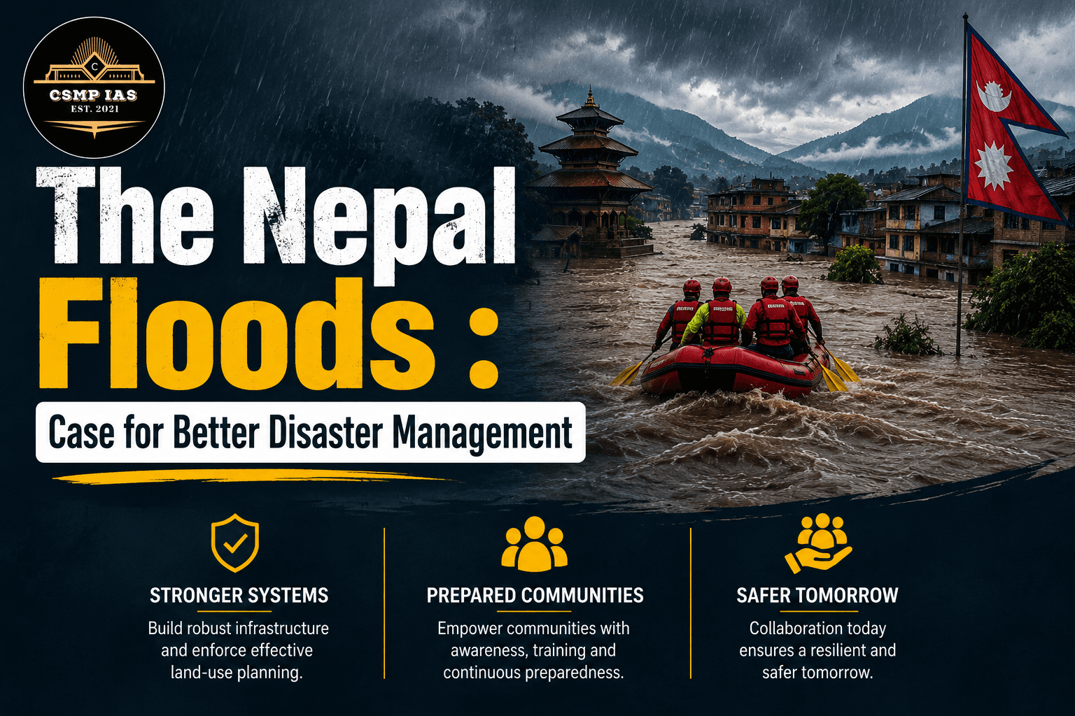
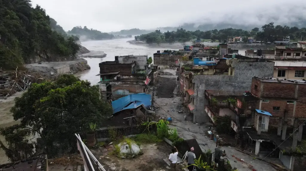
On the morning of 26 August 2026, a wall of water, ice, and debris tore down the Bhote Koshi and Trishuli river valleys in Nepal's Rasuwa district, near the border with Tibet. Within hours, an entire stretch of the Nepal–China trade corridor — bridges, highways, hydropower stations, parked trucks, and homes — had simply vanished. By the time rescue teams could reach the worst-hit areas, official counts stood at several hundred dead, hundreds more missing, and thousands displaced. The Sino-Nepal Friendship Bridge at Rasuwagadhi, already damaged in a similar event the previous year, was destroyed again.
For a UPSC aspirant, this tragedy is not just a piece of current affairs to be memorised for the Prelims or dropped into a Mains answer as a passing reference. It is a live case study that ties together Geography (glacial and fluvial systems), Disaster Management (GS Paper III), International Relations (India–Nepal–China dynamics), Environment (climate change and the cryosphere), and Ethics (the moral obligations of neighbouring states and the international community). This blog unpacks the Nepal floods of 2026 in detail and uses them as a lens to understand disaster management as a subject — its institutional architecture, its persistent gaps, and the reforms that examiners routinely expect candidates to discuss.
What Happened: Anatomy of the Disaster
The proximate cause of the August 2026 flood was a catastrophic slope failure involving a glacier in the Langtang region, near Langtang Lirung — a peak with a grim recent history. In 2015, the same mountain produced a massive glacier collapse and debris avalanche triggered by that year's devastating earthquake, burying entire villages and killing over 350 people. In July 2025, a glacial lake outburst flood (GLOF) in the same corridor washed away the same border bridge that was destroyed again in 2026.
The 2026 event is understood to have begun with a rapid slope failure that released a huge volume of ice, rock, and water, which then travelled nearly 100 kilometres downstream along the Lende Khola and Trishuli Khola rivers. The debris flow gathered force and mass as it moved, ultimately smashing into populated areas, including the Rasuwagadhi border crossing — a vital node for China–Nepal trade and one of the few motorable links between the two countries in this sector. Preliminary satellite imagery analysis by agencies such as the US Geological Survey indicated that entire settlements, highway sections, and infrastructure had been buried.
By the days following the disaster, the human toll had become clear: hundreds confirmed dead, hundreds more missing, and close to 500 people injured, with survivors being treated in local hospitals amid a Nepali government commitment to free treatment for the injured. UNICEF estimated that over 17,000 children were left in urgent need of humanitarian assistance, and international agencies, including CARE and UNICEF, launched emergency appeals running into tens of millions of dollars for shelter, clean water, health services, and protection support — particularly for women, children, and people with disabilities, who face disproportionate risks in the chaos that follows such disasters.
Why This Keeps Happening: The Himalayan Cryosphere Under Stress
What should worry an aspirant preparing GS Paper I (Geography) and GS Paper III (Environment) is not that this was a freak event, but that it fits an accelerating pattern. Three flood disasters have struck this same general corridor in three consecutive years: 2024 (extreme rainfall flooding in the Kathmandu Valley), 2025 (a supraglacial lake outburst at the same Rasuwagadhi bridge), and now 2026 (a glacier collapse and debris flow of even greater magnitude).
Scientists studying the region point to a common underlying driver: the warming of Himalayan permafrost. Permafrost has traditionally acted as a kind of geological glue, binding rock, ice, and glacial debris together on steep mountain slopes for millennia. As global temperatures rise, this permafrost is thawing, weakening the structural integrity of high-altitude slopes and glaciers. This makes catastrophic slope failures — sudden glacier collapses that trigger massive debris avalanches and floods — more likely, even without an earthquake or unusual rainfall to serve as an obvious trigger. Some researchers have drawn comparisons to a similar glacier-melt disaster in Peru in 1941 that killed thousands, suggesting this is a global mountain hazard, not a uniquely Himalayan one.
This has direct relevance to two important UPSC themes:
First, the concept of Glacial Lake Outburst Floods (GLOFs) as an emerging Himalayan hazard, distinct from monsoon flooding, and requiring its own monitoring and early-warning infrastructure. India's own vulnerability was starkly illustrated by the 2021 Chamoli disaster in Uttarakhand, where a rock-ice avalanche triggered a flash flood that destroyed hydropower projects and killed over 200 people — a near-exact template for what happened in Nepal in 2025 and 2026.
Second, the link between climate change and disaster frequency, a theme examiners frequently test by asking candidates to move beyond generic statements ("climate change causes disasters") toward specific causal mechanisms — in this case, permafrost thaw destabilising slopes, rather than simply "more rain" or "melting glaciers" in the abstract.
The Silver Lining: Early Warning Systems That Worked
Interestingly, this disaster also offers a rare success story worth remembering for Mains answers on best practices. At the time of the disaster, Chinese and Nepali scientists had maintained a flash flood early warning system along this river corridor for years — a system credited by observers with consistently preventing casualties in the past by giving downstream communities crucial minutes to evacuate before floodwaters arrived. This illustrates a core principle of modern disaster management: even where a hazard cannot be prevented (a glacier collapse cannot be stopped), the human cost can be dramatically reduced through investment in monitoring, early warning, and community preparedness. The tragedy in 2026 was one of scale and suddenness, not an absence of any warning infrastructure — a distinction worth drawing in an answer, since it shows that even good systems can be overwhelmed by sufficiently extreme events, which is itself an argument for redundancy and continuous upgrading of monitoring networks.
Connecting to the Disaster Management Framework: What UPSC Expects
GS Paper III explicitly includes "Disaster and Disaster Management" as a topic, and the Nepal floods offer a ready-made case to structure an answer around the classic disaster management cycle: mitigation, preparedness, response, and recovery.
1. Mitigation: Reducing Vulnerability Before Disaster Strikes
Mitigation in a Himalayan context means glacial lake monitoring, restrictions on construction in high-hazard river corridors, engineered drainage of dangerously full glacial lakes, and slope stabilisation where feasible. The recurrence of disasters at the same bridge and the same general corridor in 2025 and 2026 raises the uncomfortable question of whether reconstruction after the first event adequately accounted for the risk of recurrence — a common failing across disaster-prone regions globally, where infrastructure is often rebuilt in the same vulnerable location without redesign. For India, this is directly relevant to the National Disaster Management Authority's (NDMA) guidelines on GLOF risk and the newer push for glacial lake mapping across Himachal Pradesh, Uttarakhand, and Sikkim following the 2023 South Lhonak Lake disaster in Sikkim, which itself killed dozens and destroyed the Teesta III hydropower dam.
2. Preparedness: Institutions, Early Warning, and Community Readiness
Nepal's institutional response was coordinated through its National Disaster Risk Reduction and Management Authority (NDRRMA), working alongside the Nepali Army, international agencies, and local partner organisations under a Humanitarian Partnership Platform. This mirrors India's own institutional architecture: the NDMA at the apex, State Disaster Management Authorities (SDMAs), District Disaster Management Authorities (DDMAs), and the National Disaster Response Force (NDRF) as the specialised response arm, all operating under the framework of the Disaster Management Act, 2005. A comparative point worth making in an answer is that Nepal, despite far more limited resources than India, has nonetheless built dedicated flash-flood early warning systems in high-risk river corridors — suggesting that targeted, hazard-specific investment can sometimes matter more than the overall size of a country's disaster management budget.
3. Response: The Immediate Humanitarian Challenge
The response phase in Nepal has been complicated by exactly the problems disaster management literature predicts: destroyed access routes making the worst-affected communities difficult to reach, overwhelmed local hospitals, and the need for external humanitarian appeals within days of the event. The Nepali Prime Minister's public commitment to free medical treatment for the injured, and the mobilisation of the Nepali Army for rescue operations, reflect a whole-of-government response — but the scale of the destruction (a highway and international bridge destroyed, hundreds missing in remote terrain) illustrates why response capacity is always tested most severely in exactly the remote, poorly connected areas that are hardest to reach.
4. Recovery and Reconstruction: Building Back Better
The concept of "build back better" — a phrase that entered disaster management vocabulary prominently after the 2004 Indian Ocean tsunami and was formalised in the Sendai Framework for Disaster Risk Reduction (2015–2030) — is directly tested by Nepal's repeated bridge destructions. Recovery is not just about restoring what existed before; it is about ensuring that reconstructed infrastructure is sited and engineered to withstand the hazard that destroyed it the first time, or relocated where that is not possible.
The Regional and International Dimension
For a UPSC aspirant focused on International Relations, the Nepal floods also carry a geopolitical dimension. The Rasuwagadhi crossing is a critical node in China–Nepal connectivity and trade, and its repeated destruction has implications for the Belt and Road-linked infrastructure ambitions both countries have discussed. India, as Nepal's other major neighbour, has historically played a significant role in disaster relief in Nepal — most visibly after the 2015 earthquake, when India's "Operation Maitri" was among the first and largest international responses. Neighbourhood disaster diplomacy of this kind is a recurring theme in India's "Neighbourhood First" policy discussions, and candidates should be alert to how India's response (or the international community's response more broadly, including UN agencies like UNICEF) evolves in the weeks following the 2026 floods, since this often becomes fodder for both Prelims current affairs and Mains questions on India's regional humanitarian role.
Key Takeaways for Answer Writing
For Mains preparation, this event can be woven into several potential questions:
Discuss the increasing frequency of Glacial Lake Outburst Floods (GLOFs) in the Himalayan region and suggest measures for their mitigation. (GS III)
Examine the role of early warning systems in reducing disaster mortality, using a recent case study. (GS III)
"Disaster management is as much about pre-disaster mitigation as post-disaster response." Discuss with reference to a recent Himalayan disaster. (GS III)
Evaluate India's disaster diplomacy in South Asia, with reference to its response to natural disasters in neighbouring countries. (GS II)
When writing such answers, aspirants should avoid treating the Nepal floods as an isolated news item and instead position it within the broader pattern of Himalayan cryosphere instability — referencing Chamoli (2021), Sikkim's South Lhonak Lake disaster (2023), and Nepal's own repeated floods (2024, 2025, 2026) to demonstrate an understanding of trend, not just event. Examiners consistently reward answers that connect a current event to an underlying structural or scientific cause, cite the relevant institutional framework (NDMA, Sendai Framework, Disaster Management Act 2005), and end with forward-looking, specific recommendations rather than vague calls for "better coordination."
Conclusion
The 2026 Nepal floods are a sobering reminder that in the Himalayas, disaster risk is not static — it is intensifying as the region's permafrost and glaciers respond to a warming climate. For UPSC aspirants, the tragedy underscores why disaster management cannot be treated as a standalone, technical subject confined to GS Paper III. It sits at the intersection of geography, environment, governance, and international relations, and the best answers will be the ones that show this interconnectedness clearly. As South Asia braces for what may be a new normal of recurring glacial disasters, the policy choices made in the coming years — around early warning investment, hazard-informed reconstruction, and regional cooperation — will determine how many of these events remain natural hazards, and how many become preventable human tragedies.
This piece is current as of the events of late August 2026. Aspirants are encouraged to track official updates from Nepal's NDRRMA and India's NDMA for the latest verified figures, as death and displacement tolls in the immediate aftermath of such disasters are often revised.